Date: TBD
Location: Baley Canyon Wilderness ParkTime at Trailhead: 07:00AM
Parking: 451 W Carter Ave, Sierra Madre, CA 91024
Distance: 6.3 Miles
Elevation Gain: 2216 ft
Route Type: Out & Back

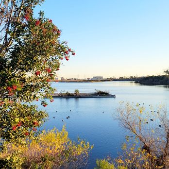
Experience the scenic trails of Anaheim.

Let's play!

Another wonderful year with wonderful friends

NOVEMBER

Click to unhide name

Click to unhide name

Click to unhide name

Click to unhide name

Location: Oak Mesa Park, 5400 Wheeler Ave, La Verne, CA 91750


Location: Weir Canyon
Info: Hiking Guy
Review
Time at Trailhead: 07:30AM
Parking: 6984 E Overlook Terrace, Anaheim, CA 92807, Santiago Oaks Regional Park
Distance Options: 2.8 Mi, 4.2 / 6.8 Mi, 9.7 Mi
Route Type: Loop, Figure-8


This hike offers little to no tree shade, so plan accordingly. Hiking boots and poles are helpful, but the path resembles a running trail, so regular shoes will also work.
All groups are together for the first mile. Circle then makes loops it way back, while square and diamond routes continue for an additional 1.25 miles, looping back to the same trail as the circle. All routes eventually lead back to the starting point.
The square and diamond routes continue the figure 8, including some inclines that offer rewarding views of Anaheim Hills. The diamond route covers a larger loop with two additional inclines, making it more challenging.
In the end, all paths reconnect and finish at the starting point.


Location: Cobb
Estate Trailhead Echo Mt
Time at Trailhead: 08:00AM
Parking: Lake and E Loma Alta Dr, Pasadena
Distance: 5.5 Miles
Route Type: Out and back
Location: JPL, Pasadena
Time at Trailhead: 09:00AM
Parking: JPL
East Lot Parking
Distance: 5.9 Miles
Route Type: Out and back
Location: Free day to hike anywhere / La Canada
Distance: TBD / 10 Miles
Route Type: TBD / Loops
Location: Cobb
Estate Trailhead Echo Mt
Time at Trailhead: 05:00PM
Parking: Lake and E Loma Alta Dr, Pasadena
Distance: 5.5 Miles
Route Type: Out and back
Location: Cobb
Estate Trailhead Echo Mt
Time at Trailhead: 06:30AM
Parking: Lake and E Loma Alta Dr, Pasadena
Distance: 5.5 mi / 16.5 mi
Route Type: Out and back / Loop